CeRDI Newsletter Autumn 2024
CeRDI 25-year Anniversary: Showcasing Another Five of our Best Projects
In the last two newsletters (Spring 2023; Summer 2024) we showcased projects that have marked CeRDI’s success and 25-year anniversary. In this issue, we’re continuing the series and further demonstrating the unique and important research and technology achievements over CeRDI’s journey.
-
My Farm Dashboard
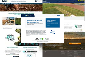
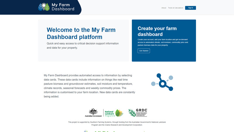
My Farm Dashboard assists farmers to make better decisions based upon critical support information and data about their property. CeRDI developed the My Farm Dashboard following extensive collaboration with industry organisations. Southern Farming Systems was the lead partner on the project together with a diverse partnership of high rainfall zone cropping project partners.
My Farm Dashboard incorporates a number of specialist tools including a state-of-the-art satellite pasture estimation model; a Lime Assist calculator; a shared data network providing localised climate data from soil moisture probes and weather monitoring stations; climate information and rainfall predictions from the BoM ACCESS three-month climate model; and commodity price information enabling farmers and advisors to examine historic weekly prices for major commodities. Co-designed with end-users and enhanced through extensive collaborations, the portal has received national interest that recently led to a new project partnership with NSW DPI to extend the climatic data in the My Farm Dashboard. For more information CeRDI Summer newsletter 2024.
The project was funded by the Australian Government’s National Landcare Program and the Grains and Research Development Corporation (GRDC). PhD research conducted by Dr Rekha Attanayake was aligned with aspects of the My Farm Dashboard initiative.
Visualising Australiasia's Soils
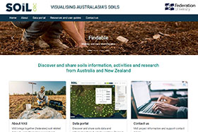
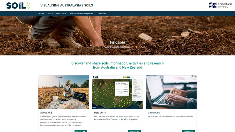
Visualising Australasia’s Soils (VAS) provides participants of the Cooperative Research Centre for High Performance Soils (Soil CRC) with access to reliable quality soil data. The data is sourced from a federation of soil data custodians who share their data according to the rules they set. CeRDI is the lead partner on this project. The first phase of the project (2018-2021) resulted in the successful development a cloud based, research data federation for soils, with spatial mapping guidelines. The second phase (2021-2024) of the project expanded VAS to enable full data sharing, data access and usage for Soil CRC participants. The third phase of VAS, to commence shortly, will involve activities to ensure VAS legacy beyond 2027.
VAS is a flagship project for CeRDI involving complex and challenging research. It involves collaborations with partners across agriculture, both nationally and internationally, with substantial input from the Soil CRC and other universities.
Hyper Yielding Crops
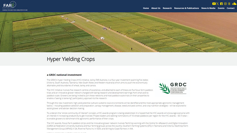
Hyper Yielding Crops is a major agriculture initiative that commenced in 2020 with the aim of maximising cropping yields in high rainfall areas. Funded by the GRDC under the leadership of the Field Applied Research Australia, the project has informed the setting of attainable grain yield targets in regions where there is the potential for high yield cropping. The project established five GRDC Centres of Excellence for research, development and extension with hubs located in Western Australia, South Australia, Victoria, Tasmania and New South Wales. A series of Focus Farms and Award sites associated with each Centre of Excellence provided demonstration, comparison, and extension of crop management practices for optimising yield. CeRDI developed the online data management and reporting platform for the Focus Farms and Award sites, in partnership with key collaborators including FAR, Techcrop, and four farming groups: Southern Farming Systems, MacKillop Farm Management Group, Riverine Plains Inc., and Stirlings to Coast Farmers (in Western Australia).
The awards component of the Hyper Yielding Crops project has been instrumental in driving participation and innovation among farmers. The awards recognise top-performing farmers and their innovative practices, support the sharing of knowledge, encourage experimentation, create a sense of community among participants and have contributed to advancing grain production in Australia, making farming more efficient, sustainable and productive.
A video about the project is available at: https://www.youtube.com/watch?v=UYYgzv_9ttA 
National WaterBug Blitz
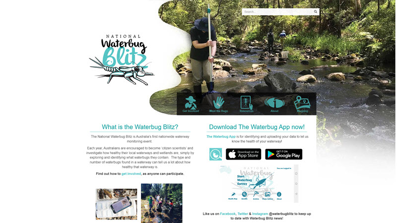
The National Waterbug Blitz is a citizen science project culminating in a nationwide waterway monitoring event. This unique citizen science project supports the assessment of the health of the nation’s waterways by exploring local waterways and wetlands to identify what aquatic macroinvertebrates (“waterbugs”) they contain. The project was coordinated by CeRDI’s Dr Birgita Hansen in partnership with Waterwatch, Corangamite Catchment Management Authority, Envirocomm Connections and The Waterbug Company. In 2019 the first of the ongoing spring monitoring events commenced. They employ effective methods to support waterways monitoring, assisting in the collection, sorting and identification of waterbugs in local waterways. The National Waterbug Blitz mapping portal was established during the project, enabling important developments to the online resources and mapping tools to occur alongside the current monitoring event. The National Waterbug Blitz has evolved to now offer environmental monitoring tools for councils and CMA's alongside its offerings for citizen scientists.
A series of short videos were developed to complement the monitoring activities and to involve and inform citizen scientists and the community: https://www.waterbugblitz.org.au/Resources 
Visualising Ballarat
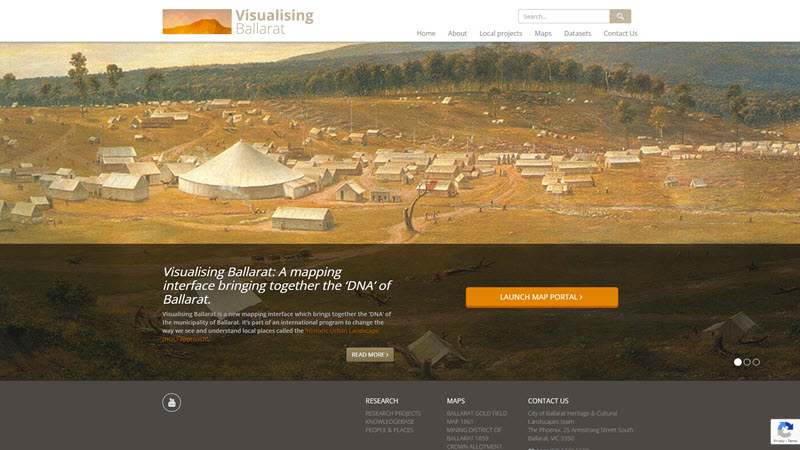
Visualising Ballarat, a knowledge management and urban planning tool was developed by CeRDI in collaboration with the City of Ballarat. Visualising Ballarat provides access to an expanded dataset relating to Ballarat’s historic, contemporary and natural landscapes. It was designed for a host of stakeholders that include community members, practitioners and researchers. The data sets available pertain to historic landscapes, trees, parks, views, and landmarks, natural landscapes, geology, services and infrastructure, boundaries and regulatory tools.
This is the most comprehensive collection of spatial data for Ballarat and draws heavily upon legacy data. It is a comprehensive and important local resource that has been well received by the community.
Visualising Australasia’s Soils Phase 3
CeRDI recently received confirmation that the Soil CRC will extend funding for VAS until 2027. During this time a range of activities will be undertaken, many of which will be aimed at ensuring the system’s legacy.
In the third phase, extensive work will be undertaken to transform VAS into an enduring Australasian soils knowledge system that is self-sustaining and inherently useful, for research and education. This will be complemented by the development of a VAS governance model, which will include data governance and stewardship guidelines for managing VAS beyond 2027. This is an important activity necessitating involvement from project partners to ensure the system’s future viability and endurance as an integral part of the Australian soil data ecosystem.
-
Another activity to be undertaken during the next phase of VAS is exploring the application of artificial intelligence to get greater benefit from the stored data. This will strengthen and expand the value of soil performance data, enhancing the reporting of soil quality, function and target values for high-performance soils based on analytics of soil data.
As VAS moves into Phase 3, a seamless transition will occur. Activities for VAS Phase 2 will be completed by the end of July after which time, VAS Phase 3 will commence. During this time, project activities will continue seamlessly, and partners can continue to use VAS without disruption.
Visualising Australasia’s Soils: Extending the Soil Data Federation
The following story about Visualising Australasia’s Soils was featured in the April issue of the Soil CRC newsletter:
The Soil CRC’s Visualising Australasia’s Soils (VAS) project provides an online portal to quality soil data from across Australia and New Zealand. Project Leader Associate Professor Peter Dahlhaus from Federation University Australia said VAS is a dynamic web-based platform where Soil CRC researchers, farmers and the broader agricultural industry can share soil information, activities, and research findings.
“VAS uses innovative technology to bring together (federate) a large array of reliable soil datasets from government agencies, industry and grower groups, and individual farmers,” he said. “This data can be interrogated to provide insights into local soil types and constraints, which can help inform soil management practices.”
-
The project is now in phase two, which aims to create an independent and enduring soil research data federation of public and private sector data.
Associate Professor Dahlhaus said key objectives of VAS are to motivate soil data custodians to make their data Findable, Accessible, Interoperable and Reusable (FAIR), and align with other national and international soil research data initiatives to maximise discovery and reuse.
“VAS relies on individuals and organisations uploading, utilising and sharing their soil data, and we’re fortunate to have 19 Soil CRC participants, including 15 farmer groups, using the VAS portal to explore their soil data.”
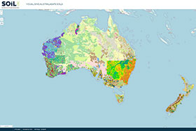
VAS now contains data for 2891 sites, with 9788 samples, and 200,707 observations. Datasets continue to be added by project participants through the self-serve system before being mapped into the VAS portal for users to access.
“Importantly, the data custodians maintain ownership and control of their data, and they set the rules around if their data can be shared and under what conditions their data can be used,” he said.
“The project team has developed guidelines for the use and application of data in the portal to ensure appropriate data governance, licensing and access controls are in place.”
Consultation with participating landholders revealed the importance of defining the value proposition of VAS and why it’s worth contributing to. Associate Professor Dahlhaus explained the benefits of participating are numerous, including understanding what data is available for your region and how to use it to your advantage.
“During the life of the project, we’re committed to reporting back to data contributors about the value of their soil data and what it means in terms of soil performance,” he said.
The VAS interface has received a face-lift recently, to improve the user experience and provide additional resources and user guides. The revamped platform is expected to launch later this month and will remain accessible via the Soil CRC website.
Another recent highlight is the inclusion of soil moisture probe data in the VAS portal. Project participants Southern Farming Systems and Agriculture Victoria were involved in an initial soil moisture data trial, with their probes recording data for VAS. This information is now available, and users can access real-time plant available water for around 100 Victorian probe sites (with more to come).
The project team will continue to monitor and assess the impact of VAS and collaborate with our project partners to make ongoing improvements, increase usage, and ensure the data remains FAIR.
“Ultimately, we want VAS to be a self-sustaining and inherently useful tool for soil research, education and farmer decision-making,” Associate Professor Dahlhaus concluded
Source: https://soilcrc.com.au/soil-data-federation/ 
VAS portal: https://vas.soilcrc.com.au/ 
VAS Project overview: https://soilcrc.com.au/current-projects/#project_2_3_002 
Securing the Future of the Gippsland Lakes: Report
The Gippsland Lakes comprise the largest estuarine lagoon system on the Australian continent and the largest coastal wetland complex in southeastern Australia, encompassing linked and isolated lagoons, swamps, active and abandoned river and tidal channels within the Gippsland Basin. The Lakes are one of 12 wetland systems in Victoria currently listed under the Ramsar Convention on Wetlands, an international agreement for the conservation of wetlands. The Lakes have been listed as a Ramsar site since 1982, covering over 600 square kilometres. Once the entire terrestrial catchment area is taken into consideration, the area of concern takes in 20,000 square kilometres.
A report was released earlier this year from the Royal Society of Victoria (RSV) in the context of the East Gippsland Catchment Management Authority’s renewal of the Gippsland Lakes Ramsar Site Management Plan which aims to revisit and re-establish a framework for the maintenance of the Lakes’ unique ecological characteristics through “the promotion of conservation and wise, sustainable use.” It follows a concern with the nature and health of the Gippsland Lakes sustained by the RSV for almost 60 years, dating from the East Gippsland Symposium held in 1967 and the subsequent publication of related papers in the Proceedings of the Royal Society of Victoria.
-
CeRDI’s Dr Birgita Hansen was a contributing author on the report and provided an overview of the status of waterbirds in the Ramsar, based on decades of volunteer monitoring. This report draws on scholarship presented from a roundtable held at the RSV on 26 May 2023 involving research expertise with First Nations representation. It summarises the geomorphological character of the Lakes system, the current state of estuarine health, and anticipates the impacts of a drying regional climate and rising sea levels on the interaction of the marine and freshwater ecological conditions.
 |
|
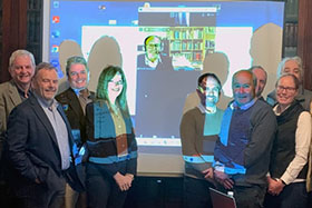
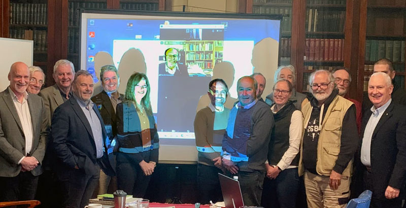
Above roundtable presenters and participants, from Left: Dr David Low, Professor Bruce Thom AM, Mr Duncan Malcolm AM, Dr Michael Spencer, Professor Jamie Pittock, Dr Kathleen McInnes, Mr Neville Rosengren (on screen), Professor David Kennedy, Professor Peter Gell, Professor Perran Cook (obscured), Dr Birgita Hansen, Dr Jason Alexandra (obscured), Professor Max Finlayson, Mr Michael Vanderzee, Mr Rob Gell, Mr Sean Phillipson (obscured) (Photo courtesy of Mike Flattley).
|
Recommendations in the report are grouped under these four categories:
1. Share Knowledge for Collective Understanding
2. Address Knowledge Gaps to Enable Adaptive Decision Making
3. Establish and Maintain an Adaptive, Collaborative Governance Regime
4. Intervene and Invest for Ecological and Cultural Resilience
The RSV is calling for sustained research to fill substantial gaps in our collective knowledge base to enable more informed and effective decision making. To this end, the report’s recommendations are to raise awareness of the threat to the iconic coastline of the Outer Barrier (90 Mile Beach) posed by rising sea levels, along with the manifold pressures placed on wildlife and habitats by the growth of human industries, activities and population.
The report can be downloaded at: https://rsv.org.au/wp-content/uploads/Securing-the-Future-of-the-Gippsland-Lakes.pdf 
RSV is producing a special issue in the society journal, based on the forum and report. Dr Hansen and co-authors Chris Healey (BirdLife East Gippsland), Deb Sullivan (BirdLife Australia) and Dan Weller (SMEC) have a paper appearing in this special issue on Waterbird and migratory shorebird monitoring in the Gippsland Lakes.
For further information about this project, contact Dr Birgita Hansen: b.hansen@federation.edu.au
AgTech Finder Podcast: Data Codes
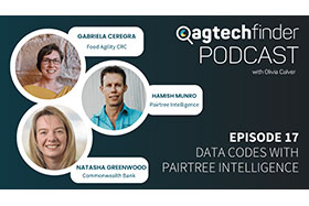
CeRDI’s Data Policy Manager, Gabi Ceregra, recently participated in a podcast about the value of data and the need for farmer’s data to be protected.
Data has become one of the world’s most valuable commodities and while it needs to be protected, data sharing is advantageous, leading to a host of industry benefits, including improved profit and production on-farm. The National Farmers' Federation recently sought to address this issue and has developed the Australian Farm Data Code. This is a voluntary code of conduct and certification program that aims to improve the adoption of agtech by ensuring farmers are comfortable with how their data is used.
-
In the podcast, host Olivia Calver asks how farmers can feel confident in sharing their data with third parties, such as agtech providers. The podcast explores data codes, with Gabi taking an in depth look at the Australian Farm Data Code and discussing why it was introduced and how agriculture technologies have responded to the code. During the podcast Pairetree Intelligence co-founder Hamish Munro and the Commonwealth Bank’s General Manager of Agribusiness Natasha Greenwood discuss products and collaborations linked to Farm Data Codes.
This podcast is one of a series that was created and published by AgTech Finder. ‘Data codes with Pairtree Intelligence’ is the 17th episode of informative podcasts delivered by AgTech Finder: https://www.agtechfinder.com/educational-resources 
Gabi Ceregra works in CeRDI as the Data Policy Manager for the National Farmers’ Federation and Food Agility CRC. Gabi specialises in data governance and brings a wealth of experience in managing data across health, financial services, and agriculture. Her recent work in agriculture data governance includes the Australian Farm Data Code and certification, the formulation of best practice Data Sharing Agreements, and the establishment of Australian Agricultural Traceability data standards.
To access the podcast visit: https://www.agtechfinder.com/agtech-info/ep-17-data-codes-with-pairtree-intelligence 
Draft Data Interoperability Framework: For Public Comment
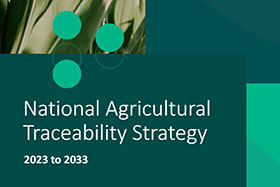
CeRDI’s Gabi Ceregra is Co-Chair of the Department of Agriculture, Fisheries and Forestry (DAFF) Australia Agricultural Traceability Data Standards Working Group. The Working Group recently developed a draft framework on data interoperability, designed to improve traceability and sustainability reporting outcomes for Australia’s agriculture sector. The framework is available at the DAFF website and is available for public consultation. The Framework was created as part of a $5 million grant awarded to Food Agility Cooperative Research Centre to test data-enabled traceability concepts and facilitate industry and government alignment on data standards.
Soil Indicators Project: Update
Soil indicators are observations, assessments and measurements used in agriculture to obtain essential information about the physical, chemical, and biological condition of soil. These indicators help farmers and advisors understand how soil performs for their enterprise, soil type and climate. The Soil Indicators project was initiated to identify what indicators work best for different farming systems and regions, providing information and guidance about the best indicators for agriculture production systems. The research was led by Dr Nathan Robinson, Assoc Prof Peter Dahlhaus, Dr Aakansha Chadha and Dr Alison Ollerenshaw from CeRDI in partnership with Charles Sturt University and the University of Newcastle and supported by the Soil CRC.
-
Soil health plays a crucial role in the success of farming. While the application of soil indicators within agriculture is widespread, little is known about the factors farmers use to make decisions about soil indicators on their farms. The first phase of this 2.5-year project involved an extensive program of research that included the collection of survey data from farmers, agronomists, and researchers. The findings from the research are currently being analysed and will be used to identify the factors that influence farmers’ decisions about their soils, and to understand and identify the best soil indicators needed, by farming system.
| |
 |
| |
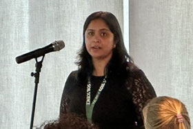
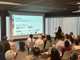
Above: CeRDI’s Aakansha Chadha presenting the
Soils Indicators project research to delegates
at the Centennial of the International
Union of Soil Science Conference in Florence,
May 2024 (Photo courtesy of Dr Michael Crawford).
|
| |
|
"This research involved extensive engagement with grower groups and farmers. As a result, we’ve collected a rich amount of data about indicators - how these are used and where farmers and others are sourcing their soil information," Dr Robinson said. He went on to comment that: “The research data is enabling us to identify ‘what works where’ to be able to provide farmers and advisors with information about selecting the best indicators for their production system, in their region.”
The research findings are being prepared for wide dissemination. Preliminary results were recently shared at an international conference: the Centennial of the International Union of Soil Science  in Florence Italy. Aakansha Chadha attended the conference and presented an overview of the research about matching soil performance indicators to Australian farming systems.
In an exciting new development, the research team recently received confirmation of an extension to funding for the research, with support from the Soil CRC. Over the next two years, the second phase of the project will be undertaken, involving a co-design process in which domain and regional experts will support the development of relevant metrics for indicators that matter to farmers and advisors. The project will identify the combinations of soil type, climate, and land use linked to local and relevant management practice information for soil performance. This will inform corrective actions and management options to improve soil performance and health.
For more information: https://soilcrc.com.au/current-projects/#project_2_1_006 
Central Highlands Grower and Producers Research
CeRDI is conducting research which has been funded by the Victoria Drought Resilience Adoption and Innovation Hub and Commerce Ballarat to better understand access to markets and infrastructure, and identify barriers and opportunities to business growth. The project focuses on artisan and small-scale growers, producer and/or associated retailer/businesses across the Central Highlands.
The project was designed by CeRDI’s Prof Helen Thompson, Jude Channon, Dr Alison Ollerenshaw and Jennifer Corbett with information collected via an online survey which has been circulated widely across the region. Extended research activities, comprising interviews are now being planned.
-
It is anticipated that this research will provide a comprehensive understanding the support growers and producers across the region would benefit from to improve knowledge sharing, networking, business development and sector growth. This will provide Commerce Ballarat with insights that will assist them to identify opportunities to support the small-scale agriculture sector, provide advocacy, and deliver industry events for ongoing development across the sector and the region.
Valuing Urban Wetlands: Launch
 |
|
|
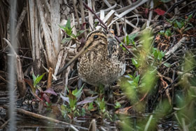
Latham’s Snipe at Glen Ordern Wetlands
near Werribee. Photo: David Jenkins
|
|
| |
|
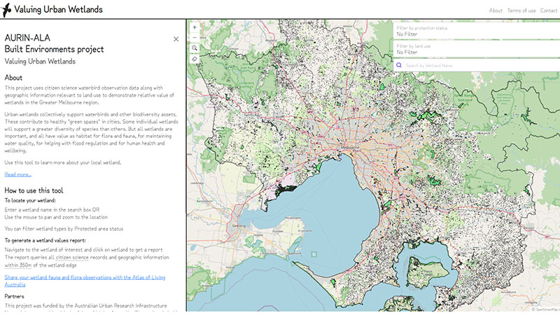
Urban wetlands are important biodiversity refuges. They contribute to healthy "green spaces" in cities, as well providing habitat for flora and fauna, maintaining water quality, and helping with flood regulation.
In a partnership between the Atlas of Living Australia (ALA), the Australian Urban Research Infrastructure Network (AURIN) and BirdLife Australia, Dr Birgita Hanssen has led a small CeRDI team to create an online mapping tool to help raise awareness of the importance of wetlands in urban environments. The team used open-source citizen-science data to quantify the values of urban wetlands across Victoria, including those that have previously been overlooked. This information was collated into a publicly available online mapping tool, ‘Valuing Urban Wetlands’.
-
The tool integrates waterbird, frog and built environment data in the mapping portal . Waterbird data collected through citizen science and professional science was accessed via the ALA and overlayed with open landscape data to create metrics for assessing wetland health and importance. The tool focuses on the Greater Melbourne region, but the methodology can be applied to other regions in the future.
The mapping portal includes a snapshot on the project case study species, Latham’s Snipe (Gallinago hardwickii).
| |
 |
| |
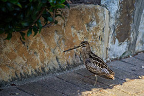
An injured snipe finds no refuge in a heavily
urbanised area in Queensland.
Photo: Francis Johns
|
| |
|
Latham’s Snipe is a migratory shorebird that breeds in Japan and migrates to Australia in spring, where it relies on a range of wetland habitats. It is a cryptic bird and difficult to observe, but research has revealed very high numbers of snipe in urban wetlands across much of their Australian range. Through mapping tool helps identify wetlands important to support Latham’s Snipe in Greater Melbourne, and annual numbers recorded at these wetlands are included in wetland report.
This project is intended raise awareness of urban wetlands, help inform decision-making, produce simple, standardised metrics based on citizen science data, and help improved fauna monitoring by highlighting information and gaps in urban areas.
For more information about this project, you can read the ALA blog or contact the project lead b.hansen@federation.edu.au.
Staff profile: Simon Shields
 |
|
|
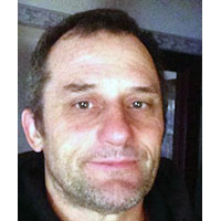
Technical Officer
Simon Shields
|
|
| |
|
Simon came to CeRDI with a diverse education and employment history. He first completed a Bachelor of Applied Science at RMIT, with post graduate studies in photogrammetry and remote sensing. Simon started his career as a land surveyor, contributing to projects including the Savage River Tasmania Mining Survey and working on the Bass Strait ESSO Riggs, undertaking precise traversing.
During the 1990’s, Simon returned to study and completed a Bachelor of Computer Science from Monash University. This led to a career as a software and systems engineer in which he was first employed at Monash University, then the Latrobe Regional Hospital. Simon has worked as a contractor with IBM and as a consultant and trainer with TUSC Computing Systems and Eirteic.
Simon brings a range of programming and development skills and has recently been adding to these through his participation in the Federation TAFE Certificate IV in Cyber Security.
-
Joining CeRDI in March 2024, his casual role as a technical officer is providing the team with additional capacity while some longer term roles progress through recruitment processes. His current focus is on creating ansible playbooks to configure CeRDI’s computer servers.
Outside of work, Simon is a qualified Judo teacher and has a NiDan (2nd Dan Black Belt) in Judo and a yellow Belt in Aikido. Simon has five children and 10 grandchildren.
Student profile: Rida Mazhar
Rida Mazhar commenced her PhD with CeRDI in March 2024, focusing on research titled "Maximisation of Data Integration and Interoperability for Better Regional Outcomes." The aim of her research is to investigate the utilisation of data sharing and cutting-edge smart technologies to enhance liveability, prosperity, innovation, safety, and social connectedness within the rapidly expanding City of Ballarat. By leveraging data visualisation and analytics, she seeks to improve urban planning processes.
Rida’s research specifically targets smart city dimensions such as mobility, renewable energy, and governance in regional urban contexts, with a particular emphasis on how Ballarat can advance towards achieving its smart city objectives through the application of data science and integration technologies. The anticipated outcome of her research is the development of a comprehensive framework or model designed to optimise the use of municipal data and information for multiple and sustainable purposes.
-
Rida completed a Bachelor’s degree in 2015 in Geoinformatics Engineering from the National University of Sciences and Technology (NUST) in Pakistan. During this time, she interned at Pakistan Telecommunication Limited where she gained experience in network planning using GIS software. Her final year project involved the development of a system that provided real-time sensor data and landslide warnings via a website, alongside evacuation route suggestions.
After a year of secondary school teaching, Rida the began a Master of Science in Urban and Regional Planning. Her Master’s thesis entailed a comprehensive service and comparative analysis of traditional and modern bus systems using qualitative and quantitative research methodologies. At the same time, Rida also worked as a GIS Research Associate and as a Research Assistant. After completing her Master’s degree, she continued to expand her knowledge of smart cities, Google Earth Engine, and Python through various online resources, driven by her keen interest in integrating technologies within city planning—a pursuit that synthesises her undergraduate and graduate expertise.
Rida’s PhD is supervised by Prof Helen Thompson (Principal), and Dr Shoaib Riaz from Federation’s Institute of Innovation, Science and Sustainability. Rida’s research is supported by the Destination Australia and Department of Education Stipend Scholarship through Federation University Australia.
News Snippets
Early Career Research Funding: Three researchers in CeRDI were successfully awarded Early Career Seed Funding from Federation University, including:
- Dr Chris Bahlo. Project title: Enabling the discovery of sheep welfare information from public datasets.
- Dr Aakansha Chadha. Project title: A mechanistic model for surface applied lime and movement through soil.
- Dr Alison Ollerenshaw. Project title: Impact of the Dementia Pathways Tool
More information about these projects will be included in the next newsletter.
-
Times Higher Education: An article featuring the research of Dr Birgita Hansen was recently published in the Times Higher Education. The article documents the avian research that Birgita has spearheaded during her academic career and highlights her inspiration for shorebird protection through the protection of their wetland habitats. The article is available at: https://www.timeshighereducation.com/hub/p/how-bird-hand-inspired-researchers-quest-protect-wetland-species 
Presentation to the National Committee on Soil and Terrain (NCST): Assoc Prof Pete Dahlhaus spoke about Visualising Australasia’s Soil at the annual NCST meeting held in Canberra in late May. The presentation included a live demonstration of the site and detailed next steps resulting from securing 2.5 years of funding for phase three of the VAS program.
Recent conference presentations and refereed publications:
Bahlo, C. (2024). Advancing FAIR Agricultural Data: The AgReFed FAIR Assessment Tool. Data Science Journal, 23 (18) 1–11. DOI: https://doi.org/10.5334/dsj-2024-018  .
.
Dahlhaus P. & Peterson T. (2024) Foreword in Deborah Wardle (Ed.) Understanding aquifers through groundwater stories. A collection of writing from a fieldwork day on the Barwon Downs borefield. Deborah Wardle Books. ISBN 978-0-646-89301-3.
Gould, L.A., Manning, A.D., McGinness, H.M., Hansen, B.D. (2024) A review of electronic devices for tracking small and medium migratory shorebirds. Animal Biotelemetry 12(11), https://doi.org/10.1186/s40317-024-00368-z  .
.
Hansen, B.D., Healey, C., Sullivan D., Weller, D.R. (In Press) Waterbird and migratory shorebird monitoring in the Gippsland Lakes. Royal Society of Victoria Journal Special Issue on the Future of the Gippsland Lakes.
Ollerenshaw, A., Murphy, A., McLaren, S., & Thompson, H. (Accepted). The integral role of incubator managers in supporting tenants’ positive psychological wellbeing. Small Enterprise Research.
Robinson, N., Chadha, A., & Ollerenshaw, A. (2024). Matching soil performance indicators to Australian farming systems. Centennial of the International Union of Soil Science, 19-21 May, 2024, Florence Italy. Conference Abstract Book: https://drive.google.com/file/d/1mcbITzR1wfY1b4vLAaceHAyg_y_K3vzq/view?pli=1  .
.
Senanayake, I.P., Pathira Arachchilage, K.R.L., Yeo, I.-Y., Khaki, M., Han, S.-C., Dahlhaus, P.G. (2024) Spatial Downscaling of Satellite-Based Soil Moisture Products Using Machine Learning Techniques: A Review. Remote Sensing, 16, 2067. https://doi.org/10.3390/rs16122067  .
.
Smith, G., Ascui, F., O’Grady, A., & Pinkard., E. (2024). Indicators for measuring and reporting corporate nature-related impacts, dependencies, and risks. Environmental and Sustainability Indicators, 22, 100351. https://doi.org/10.1016/j.indic.2024.100351  .
.
Weir, P., & Dahlhaus, P. (2023). In search of pragmatic soil moisture mapping at the field scale. A review. Smart Agriculture Technology, 6, 100330. https://doi.org/10.1016/j.atech.2023.100330  .
.
New staff: Cedar Martin recently join the Visualising Australasia’s Soils (VAS) CeRDI team. Cedar is working on harmonising and integrating soils data contributed from farming systems groups, catchment management authorities and others. She is also assisting with mapping VAS data to international standards. Cedar is supporting project partners engagement and the enhancement of data literacy. For more information about VAS: https://vas.soilcrc.com.au/ 
HDR News
 |
|
|
PhD Candidate: Peter Weir
|
|
| |
|
Thesis Examination: Congratulations to CeRDI PhD candidate Peter Weir who submitted his thesis, incorporating published papers, for examination. The title of Pete’s thesis is: In-Paddock Variability of Plant Available Water. Peter’s supervisors are Assoc Prof Peter Dahlhaus (Principal) and Dr Nathan Robinson, Assoc Prof Peter Vamplew (Associate Supervisors).
Summary of Thesis
In dryland agriculture, the amount of water available to grow a crop is determined primarily by the in-season rainfall and the amount of water stored in the soil profile prior to seeding of the crop. Due to the heterogeneity of rainfall, single-point direct measurements of soil water content are unsuitable to determine the volumetric quantity and its distribution within the field. Soil moisture is a major limiting factor in most dryland agricultural production systems around the globe. The areal extent of rainfall remains one of the most challenging meteorological variables to model accurately due to its high spatial and temporal variability.
-
The availability of merged weather radar data with rain gauge data offers a practically usable and affordable technology to interpolate rainfall amounts at high spatial and temporal resolution at the agricultural field scale between sparsely located rain gauges, particularly in rain-fed agricultural regions. In this research, a case study was undertaken to compare rainfall measurements from a dense rain gauge network with the output from a weather radar installation within a major agricultural cropping and pasture region. The research findings showed that using merged weather radar data with rain gauge data provides improved resolution of the spatial variability of rainfall, with the result demonstrating a significantly improved data source for agricultural water management and hydrological modelling. Knowledge of the spatial variability of rainfall at the field level can also support precision agriculture management strategies for the growing of dryland crops and pastures. Current research is still some distance away from resolving reliable, trustworthy, timely, and accurate soil moisture mapping at field-scale. The linking of soil, agronomic, and weather data with spatial information, such as electromagnetic surveys and remote sensing, will offer farmers a better understanding of what is going on below the soil surface, which until now has been difficult to assess.
 |
|
|
PhD Candidate: Pramod Gautam
|
|
| |
|
Confirmation of candidature: Pramod Gautam delivered his Confirmation of Candidature on 30 May. Pramod is conducting research entitled: Achieving Net-Zero Emissions in Agriculture: Developing Decision Support Systems for Land and Enterprise Managers. Pramod’s PhD supervisors are Prof Harpinder Sandhu, and CeRDI’s Dr Birgita Hansen and Dr Nathan Robinson.
For more information about Pramod’s research and profile visit: https://www.cerdi.edu.au/AchievingNetZeroEmissionsinAg
About CeRDI
The Centre for eResearch and Digital Innovation (CeRDI) is a research centre at Federation University Australia focused on:
- the application of information and communications technology (ICT) and the development of innovative, world class knowledge management systems;
- significantly advancing the digital literacy and knowledge management capabilities of partner organisations;
- fostering partnerships for the development and implementation of eResearch with industry, government and academia; and
- measuring the impact of eResearch and digital innovation through longitudinal research.
Contact CeRDI
For further details about CeRDI’s diverse portfolio of research please visit our website: www.cerdi.edu.au, or contact Director, Associate Professor Helen Thompson: h.thompson@federation.edu.au
Mailing Address
Centre for eResearch and Digital Innovation
Federation University Australia
PO Box 691
Ballarat Vic 3353
Office Location
Suite 15, Greenhill Enterprise Centre
Ballarat Technology Park
University Drive
Mount Helen Vic 3350
Phone: +61 3 5327 9314
Email: support@cerdi.edu.au
Subscribe to the CeRDI Newsletter Mailing List
I would like to subscribe to the CeRDI Newsletter Mailing List to receive notifications of future CeRDI Newsletters.
If you have any feedback, please email newsletter@cerdi.edu.au

