


Valuing Urban Wetlands
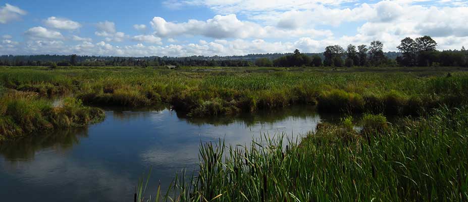
Urban wetlands are important biodiversity refuges. They contribute to healthy "green spaces" in cities, as well providing habitat for flora and fauna, maintaining water quality, and helping with flood regulation.
Background
In a partnership between the Atlas of Living Australia (ALA) ![]() , the Australian Urban Research Infrastructure Network (AURIN)
, the Australian Urban Research Infrastructure Network (AURIN) ![]() and BirdLife Australia
and BirdLife Australia ![]() , Assoc Prof Birgita Hansen has led a small CeRDI team to create an online mapping tool to help raise awareness of the importance of wetlands in urban environments. The team used open-source citizen-science data to quantify the values of urban wetlands across Victoria, including those that have previously been overlooked. This information was collated into a publicly available online mapping tool called ‘Valuing Urban Wetlands’.
, Assoc Prof Birgita Hansen has led a small CeRDI team to create an online mapping tool to help raise awareness of the importance of wetlands in urban environments. The team used open-source citizen-science data to quantify the values of urban wetlands across Victoria, including those that have previously been overlooked. This information was collated into a publicly available online mapping tool called ‘Valuing Urban Wetlands’.
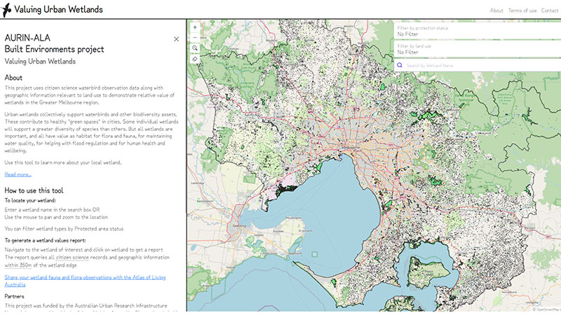 |
The tool integrates waterbird, frog, and built environment data in a mapping portal. Waterbird data collected by volunteers (citizen scientists) and professional scientists was accessed via the ALA and overlayed with open landscape data to create metrics for assessing wetland health and importance. The tool focuses on the Greater Melbourne region, but the methodology can be applied to other regions in the future.
The mapping portal includes a snapshot on the project case study species, Latham’s Snipe (Gallinago hardwickii).
Latham’s Snipe is a migratory shorebird that breeds in Japan and migrates to Australia in spring, where it relies on a range of wetland habitats. It is a cryptic bird that is difficult to observe, but research has revealed very high numbers of snipe in urban wetlands across much of their Australian range. The mapping tool helps identify wetlands important to support Latham’s Snipe in Greater Melbourne, and annual numbers recorded at these wetlands are included in wetland report.

Latham’s Snipe at Glen Ordern Wetlands near Werribee.
Photo: David Jenkins
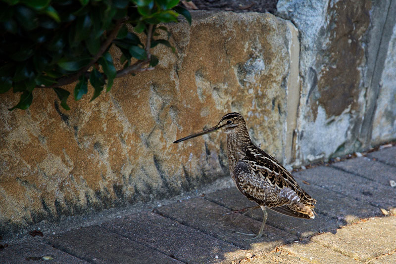
An injured snipe finds no refuge in a heavily urbanised area in Queensland. Photo: Francis Johns
Outcomes
This project is intended to raise awareness of urban wetlands; help inform decision-making; produce simple, standardised metrics based on citizen science data; and help improve fauna monitoring by highlighting information hubs and gaps in urban areas.
Innovation
The project’s innovative application of a mapping tool that combines land use and fauna data into a web portal provides an easy-to-use interface to produce tailored reports for use by researchers in all domains. The flexibility of the concept allows for future expansion across both spatial as well as scientific domains.
Technical Features
Displaying open data via an online spatial information system provides users with an interactive source of information that can be queried or filtered by wetland protection tatus or by land use. Searches by wetland name can also be made.
Approach
A collaborate approach was used to bring together relevant authorities and associated information sources into a single, practical tool for multiple users. Partners of the project, which was funded by AURIN, included BirdLife Australia, the University of Melbourne and Melbourne Water.
Future Directions
The project concept is scalable and is intended to be applicable to any urban regions. Opportunities to extend the project to include regional urban centres like Ballarat and Geelong, as well as other capitals like Adelaide and Canberra, will be explored.

TEAM MEMBERS
This project was led by Assoc Prof Birgita Hansen. The web portal development was done by Scott Limmer. Dr Judi Walters assisted with the literature review and reporting for the project, Rick Pope helped with acquisition and interrogation of spatial data, and Rahul Sinha assisted with updates based on client feedback.

NEWS
Atlas of Living Australia Blog
For more information about this project you can read the ALA project blog

New tool highlights our valuable urban wetlands - 12 June 2024
Urban wetlands are vital for supporting clean water, healthy ecosystems and bird migration but are often considered less valuable from an urban planning perspective in biodiversity conservation because they are highly modified or constructed bodies of water. Continue reading...
For news enquiries contact the project lead b.hansen@federation.edu.au.
